
Geographic View
This graphically displays the selected fire mission via the Serial Table. Blue triangle with a blue line represents the actual observer. Brown triangle with a brown line represents the observer (virtual). If both virtual observer and actual observer maps to the same position only actual observer will be shown in a Blue line and a Blue triangle. Max Ord and time of flight are also displayed in this window. The distribution of the selected serial will be shown in the Geographic View window. The Geographic View window contains layers which will expose the details of the map. The amount of layers or the map detail needed for the mission can be selected from Preferences → Instructor Control Panel → Map Layers. The selection of the layers should be done before the start of the mission.
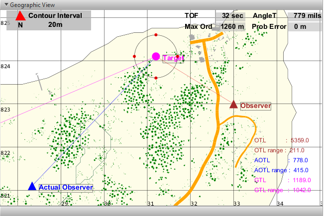
∆ Image 5l: Geographic View window |