
Terrain
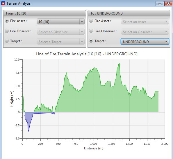
VBS3Fires provides a terrain analysis function which allows the user to view
a profile of the terrain between an observer and a target, the guns and the
target, and the guns and the observer. To activate this window, from the main
menu system: Analysis → Terrain.
When the interface is first loaded, a
label will appear stating that no data has been requested. As soon as a
gunline, observer, or a target is selected for both the beginning and end of
the analysis line, VBS3Fires will collect the necessary terrain information from
VBS3 and will display it in a graphical format.
∆ Image 12d: Terrain Analysis window |
∆ Image 12e: Terrain Analysis window |